


Description
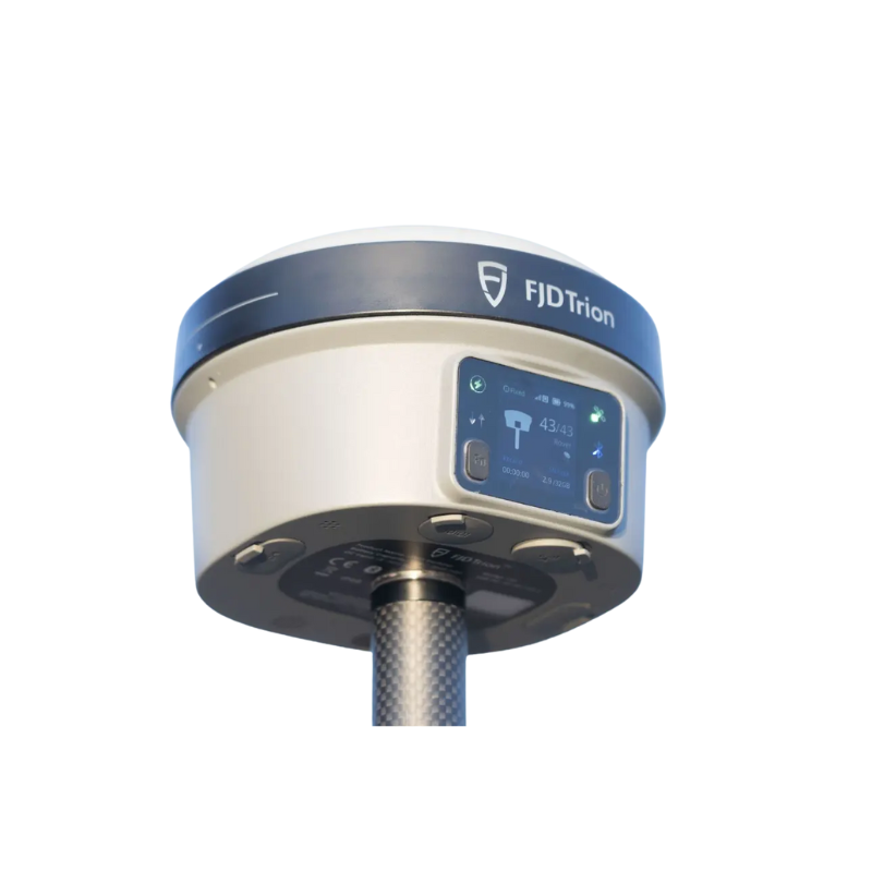
The FJD V10i GNSS Receiver redefines field productivity with advanced imaging, tilt compensation, and built-in communication features. Equipped with dual HD cameras, OLED screen, IMU, and AR-powered stakeout, the V10i allows surveyors to measure, visualize, and operate faster and safer. Lightweight, rugged, and engineered for precision, it ensures centimeter-level accuracy even in complex terrains.
Why You’ll Love It
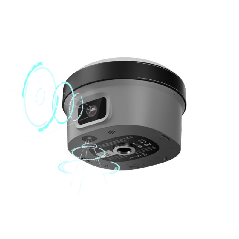
Clear vision and precise measurement: Dual HD cameras with AR Stakeout provide real-time video guidance, delivering faster and more accurate stakeouts.
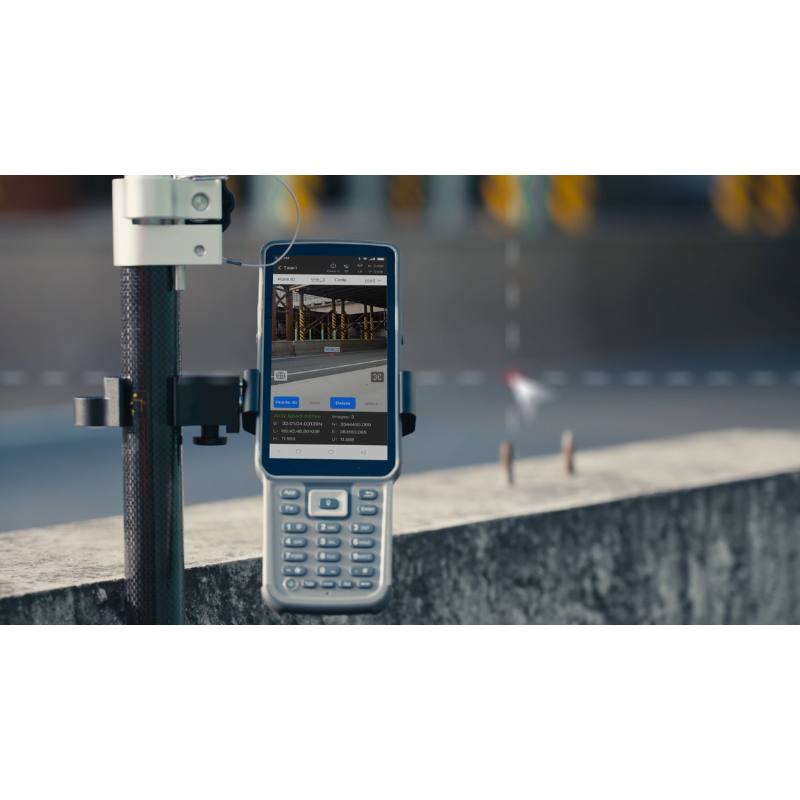
Visual Measure for hard-to-reach areas: Capture photos and obtain centimeter-level coordinates without physically accessing risky locations.
High tilt compensation: Measure at up to 60° tilt without calibration, improving efficiency in challenging conditions.
Rugged and drop-proof: Survives a 2-meter pole-drop with IP68 protection against dust and water immersion.
All-in-one connectivity: Built-in 4G LTE, Wi-Fi, Bluetooth, NFC, and UHF keep you connected without external devices.
Extended performance: 7000 mAh battery offers up to 15 hours rover operation, 25+ hours static, with fast charging support.
Smart interaction: OLED screen, hi-fi speakers, and noise-canceling microphone provide intelligent real-time feedback in any environment.
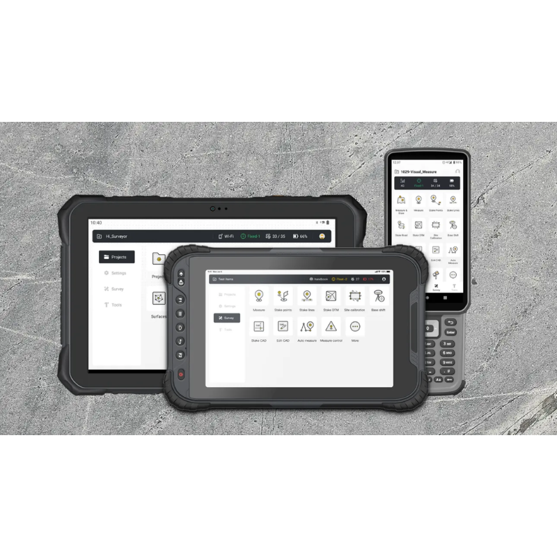
Flexible controller options: Choose between tablet or keyboard controller with bright, sunlight-readable screens.
Specifications
|
Features |
Details |
|
Channels |
1408, full constellations (GPS, GLONASS, Galileo, BeiDou, QZSS, IRNSS, SBAS) |
|
Positioning Accuracy |
RTK: H: 8 mm + 1 ppm, V: 15 mm + 1 ppm |
|
Tilt Compensation |
Up to 60°, accuracy 2.5 cm @ 30° |
|
Visual Measurement |
3 cm accuracy, 2–15 m range |
|
Initialization Time |
< 5 s |
|
Reacquisition |
< 1 s |
|
Cameras |
2 MP forward, 5 MP downward |
|
OLED Display |
1.41 in true color, sunlight-readable |
|
Battery |
7000 mAh, 15 h rover, 25+ h static |
|
Charging |
30W PD fast charge, ≤3 h |
|
Build |
IP68, 2 m drop-proof, alloy body |
|
Dimensions |
Φ130 × 83 mm |
|
Weight |
~1 kg |
|
Connectivity |
4G LTE, Wi-Fi (2.4/5 GHz), Bluetooth 4.2, NFC |
|
Ports |
USB-C, 7-pin LEMO, UHF antenna |
|
UHF Radio |
410–470 / 902–928 MHz, up to 8 km range |
|
Data Formats |
NMEA-0183, RTCM2.X, RTCM3.X, CMR |
|
Storage |
32 GB (20 GB available) |
|
Operating Temperature |
-30°C to 60°C |
|
Storage Temperature |
-40°C to 70°C |
Minimum order quantity: 5 units required. Individual units are not available for purchase at this time.
What’s in the Box
Main unit, built-in battery, charger, carrying case, UHF antenna, user manual, optional controller.
Compatibility
Ideal for surveying, construction, BIM, utilities, forestry, and agriculture. Fully integrated with FJD software ecosystem and third-party GNSS workflows.
Please note: Email info@